The images of Earth from space that we have seen so far are a long process that scientists have been doing for a long time. The process of taking images of Earth began in 1946, from images that weren’t clear until they were clear.
Photographing the Earth from space was very difficult and required launching a rocket. The resulting images are experiments from different angles and thousands of kilometers from Earth.
In 1946, a major milestone in space exploration occurred when a 35-millimeter film camera captured the first images of Earth from space every one and a half seconds.
Exactly on October 24, 1946, the camera was fired from a V-2 rocket from the White Sands Missile Range in the United States. This marks the official crossing of the Kármán Line, the boundary between Earth’s atmosphere and space, as quoted by Business Today.
Although the rocket landed suddenly and hit the ground at a speed of more than 340 mph (547 km/h), the film wrapped in steel tape miraculously survived. This can then store historical images of the earth.
After World War II, the U.S. Army again used captured German V-2 rockets for scientific exploration, including atmospheric research and improving missile defenses.
Equipped with scientific instruments, these newly designed rockets launched various missions between 1946 and 1950 and captured more than 1,000 images of the Earth from an altitude of more than 100 miles.
According to NASA’s website, the Explorer 6 satellite took the first photo of Earth on August 14, 1959 from an orbit at an altitude of about 27,359 km, but the results lacked details.
Then, on April 1, 1960, the TIROS-1 weather satellite transmitted images of the Earth from an orbital altitude of about 724 km with sufficient quality for weather forecasting, in accordance with the main purpose of the satellite itself.
The image of the Earth itself as a complete disk was successfully captured by the Soviet communications satellite Molniya 1-3 on May 30, 1966, although with less good results.
The camera that also contributed was Clyde Holliday’s camera. The camera is designed for space photography.
Clyde’s camera was instrumental in capturing the first-ever photograph of Earth from space during a V-2 rocket launch at the White Sands Missile Range.
Clyde Holliday and his team returned the images to Earth and conducted a careful analysis. You will gain valuable insights into geology, meteorology and the imaging field itself.
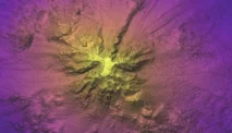
As technology advanced and the Apollo astronauts began lunar missions, cameras captured iconic and more detailed images of Earth. This image is able to reveal the complex features of the Earth.
As part of scientific research, images of the Earth were also taken from the Moon. The photo was taken on April 30, 1967 with the Surveyor 3 robotic lander, which was later visited by the Apollo 12 astronauts.
The Apollo missions of the late 1960s and early 1970s produced thousands of stunning images. Below are photos that show how small and fragile the Earth is amid the darkness and vastness of space.
The most famous photo is the Earthrise photo taken by Apollo 8, the first manned mission that orbited the Moon in December 1968.
In July 1969, the first manned lunar landing mission, Apollo 11, brought back many iconic photos by Nel A. Armstrong and Edwin E.
The famous image of the blue marble Earth that we often see on the Internet was taken in December 1972 by Apollo 17 over a distance of 115,872 km during its journey to the Moon.
Meanwhile, on March 8, 2004, the Mars Exploration Rover Spirit showed a perspective of Earth that only looked like a bright star.
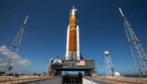
Then, 12 years ago, the Moon and Earth were photographed simultaneously from a distance of 432 km from Earth during the unmanned Artemis I mission.
Photo: Doc. NASA/Photo of Earth from space